
Bowron Lake Provincial Park topographic map
Interactive map
Click on the map to display elevation.
About this map
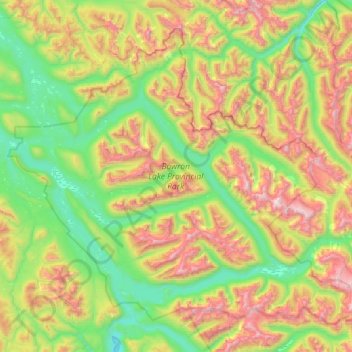
Name: Bowron Lake Provincial Park topographic map, elevation, terrain.
Average elevation: 4,738 ft
Minimum elevation: 2,684 ft
Maximum elevation: 8,717 ft
Bears are quite common in the park – black bears are numerous in the lower altitudes around the lake, and grizzly bears frequent the alpine areas. In addition to its bears, Bowron Lake Park is home to predators like cougars, wolves, wolverines, and lynx.