Geolocate

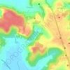
Marra topographic map

Click on the map to display elevation.

About this map

Name: Marra topographic map, elevation, terrain.

Location: Marra, Bardez, North Goa, Goa, 403511, India (15.50216 73.76945 15.54216 73.80945)

Average elevation: 89 ft

Minimum elevation: -7 ft

Maximum elevation: 272 ft

Other topographic maps

Click on a map to view its topography, its elevation and its terrain.

Anjuna

India > Goa > Bardez > Vagator

Average elevation: 39 ft

Pilerne Lake

India > Goa > Bardez > Sangolda

Average elevation: 128 ft

Corjuem Fort

India > Goa > Bardez > Corjuem

Average elevation: 43 ft

Aguada Fort

India > Goa > Bardez > Sinquerim

Average elevation: 26 ft

Anjuna

India > Goa > Bardez

Average elevation: 43 ft

Anjuna Beach

India > Goa > Bardez > Anjuna

Average elevation: 33 ft

Chapora Fort

India > Goa > Bardez > Chapora

Average elevation: 26 ft

Gear up for your next adventure:

🍳Camping Cook Set - Complete cookware for outdoor meals
🛶Inflatable Kayak - Portable kayak for rivers, lakes, and expeditions
👖Convertible Hiking Pants - Versatile zip-off pants for changing altitudes and temperatures
🎒Waterproof Dry Bags - Keep your electronics and maps dry inside your pack
🚑Emergency Bivvies - Heat-reflective sleeping bags for survival situations

As an Amazon Associate, this site earns from qualifying purchases at no extra cost to you.