Geolocate

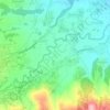
Padaasih topographic map

Click on the map to display elevation.

About this map

Name: Padaasih topographic map, elevation, terrain.

Location: Padaasih, Pasirwangi, Garut, West Java, Indonesia (-7.23416 107.81198 -7.21865 107.83291)

Average elevation: 3,143 ft

Minimum elevation: 2,959 ft

Maximum elevation: 3,412 ft

Other topographic maps

Click on a map to view its topography, its elevation and its terrain.
Gunung Sagara

Indonesia > West Java > Garut

Average elevation: 5,853 ft

sungai cimanuk

Indonesia > West Java > Garut

Average elevation: 3,133 ft

sungai cimanuk

Indonesia > West Java > Garut

Average elevation: 3,133 ft

Gear up for your next adventure:

🎒Day Hiking Backpack - Lightweight backpack perfect for day trips and outdoor adventures
🥇GPS Hiking Watch - Multi‑sport GPS watch with navigation and trail tracking
🪶Thermal Camp Blanket - Extra warmth for cold nights
🕶️GPS Smartphone Mount - Secure mount for phone navigation
🧦Hiking Socks - Comfortable socks to prevent blisters on long hikes

As an Amazon Associate, this site earns from qualifying purchases at no extra cost to you.