Geolocate

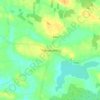
Derrywode topographic map

Click on the map to display elevation.

About this map

Name: Derrywode topographic map, elevation, terrain.

Location: Derrywode, Island ED, Ballinasloe Municipal District, County Galway, Connacht, Ireland (53.68189 -8.56242 53.69595 -8.53377)

Average elevation: 253 ft

Minimum elevation: 203 ft

Maximum elevation: 322 ft

Other topographic maps

Click on a map to view its topography, its elevation and its terrain.
Gear up for your next adventure:

🧣Merino Neck Gaiters - Multi-functional headwear for wind and sun protection
🚑Emergency Bivvies - Heat-reflective sleeping bags for survival situations
👖Convertible Hiking Pants - Versatile zip-off pants for changing altitudes and temperatures
📻Weather Alert Radios - Stay informed of storm risks while off-the-grid
🧭Outdoor Navigation Book - Learn advanced navigation skills

As an Amazon Associate, this site earns from qualifying purchases at no extra cost to you.