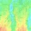
Sikeben topographic map
Click on the map to display elevation.
About this map

Name: Sikeben topographic map, elevation, terrain.
Location: Sikeben, Kabupaten Deli Serdang, North Sumatra, 20357, Indonesia (3.24122 98.54121 3.28122 98.58121)
Average elevation: 2,808 ft
Minimum elevation: 1,916 ft
Maximum elevation: 4,478 ft
Other topographic maps
Click on a map to view its topography, its elevation and its terrain.


Sibolangit
Indonesia > North Sumatra > Kabupaten Deli Serdang > Bandar Baru
Average elevation: 2,585 ft