Geolocate

Tangdong topographic map

Click on the map to display elevation.

About this map

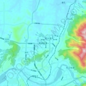
Name: Tangdong topographic map, elevation, terrain.

Location: Tangdong, Zixing, Chenzhou, Hunan, 423400, China (25.93572 113.18515 26.01572 113.26515)

Average elevation: 591 ft

Minimum elevation: 367 ft

Maximum elevation: 2,126 ft

Gear up for your next adventure:

🌧️Backpack Rain Cover - Keep gear dry in wet weather
🔭Telescopic Hiking Pole - Adjustable pole for hiking stability
🔦LED Headlamp - Bright and durable LED headlamp for night navigation
📌Outdoor GPS Map App - Apps and devices for digital topographic navigation
📶Vehicle Signal Boosters - Improve reception in rural areas while driving to trailheads

As an Amazon Associate, this site earns from qualifying purchases at no extra cost to you.