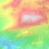
Alameda topographic map
Click on the map to display elevation.
About this map

Name: Alameda topographic map, elevation, terrain.
Location: Alameda, Antequera, Malaga, Andalusia, 29530, Spain (37.19328 -4.73575 37.25970 -4.59626)
Average elevation: 1,394 ft
Minimum elevation: 791 ft
Maximum elevation: 2,605 ft
Other topographic maps
Click on a map to view its topography, its elevation and its terrain.