Geolocate

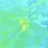
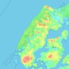
Grindsted topographic map

Click on the map to display elevation.

About this map

Name: Grindsted topographic map, elevation, terrain.

Location: Grindsted, Aalborg Municipality, North Denmark Region, 9380, Denmark (57.12894 10.02489 57.16894 10.06489)

Average elevation: 85 ft

Minimum elevation: 33 ft

Maximum elevation: 262 ft

Other topographic maps

Click on a map to view its topography, its elevation and its terrain.

Pebermosen

Denmark > North Denmark Region > Grindsted > Vandsted

Average elevation: 128 ft

Læsø

Denmark > North Denmark Region

Average elevation: 3 ft

Lindholm Høje

Denmark > North Denmark Region > Aalborg

Average elevation: 46 ft

Vendsyssel

Denmark > North Denmark Region

Average elevation: 33 ft

Mors

Denmark > North Denmark Region

Average elevation: 39 ft

Bulbjerg

Denmark > North Denmark Region

Average elevation: 26 ft

Lille Vildmose

Denmark > North Denmark Region

Average elevation: 26 ft

Egholm

Denmark > North Denmark Region > Aalborg

Average elevation: 3 ft

Gear up for your next adventure:

🥤Water Filter Bottle - All‑in‑one filter bottle for safe hydration
🔭Compact Binoculars - HD vision for scouting terrain and identifying distant landmarks
🔭Telescopic Hiking Pole - Adjustable pole for hiking stability
📦Dry Bags Set - Waterproof storage for electronics and clothes
🌡️Handheld Weather Meters - Measure wind, temp, and pressure for safe mountain travel

As an Amazon Associate, this site earns from qualifying purchases at no extra cost to you.