
Thank you for supporting this site ❤️
Make a donation
Make a donation
Gear up for your next adventure:
As an Amazon Associate, this site earns from qualifying purchases at no extra cost to you.
Madunda topographic map
Click on the map to display elevation.
Thank you for supporting this site ❤️
Make a donation
Make a donation
Gear up for your next adventure:
As an Amazon Associate, this site earns from qualifying purchases at no extra cost to you.
About this map
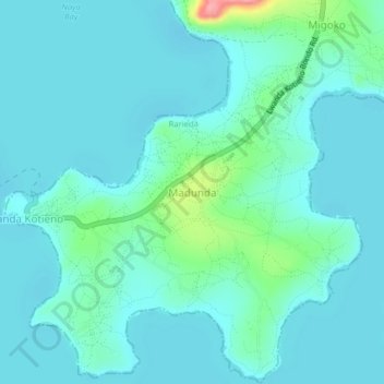
Name: Madunda topographic map, elevation, terrain.
Location: Madunda, Rarieda, Siaya County, Nyanza, Kenya (-0.40330 34.28000 -0.36330 34.32000)
Average elevation: 3,760 ft
Minimum elevation: 3,704 ft
Maximum elevation: 4,055 ft
Thank you for supporting this site ❤️
Make a donation
Make a donation
Gear up for your next adventure:
As an Amazon Associate, this site earns from qualifying purchases at no extra cost to you.