Geolocate

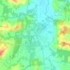
Corrabare topographic map

Click on the map to display elevation.

About this map

Name: Corrabare topographic map, elevation, terrain.

Location: Corrabare, Cessnock, New South Wales, Australia (-33.02212 151.15564 -32.87609 151.28413)

Average elevation: 732 ft

Minimum elevation: 305 ft

Maximum elevation: 1,703 ft

Other topographic maps

Click on a map to view its topography, its elevation and its terrain.
Hunter Valley

Australia > New South Wales > Cessnock

Average elevation: 230 ft

Mount Bright

Australia > New South Wales > Cessnock

Average elevation: 945 ft

Gear up for your next adventure:

🛠️Backpacking Tool Kit - Essential toolkit for outdoor repairs
🧯Portable Fire Pit - Compact fire pit for camping spots
🖼️Topo Map Wall Art - Decorative topographic prints of famous peaks and regions
🔌USB Car Charger - Car charger for on‑the‑go power needs
🌡️Portable Weather Meter - Track weather conditions on the trail

As an Amazon Associate, this site earns from qualifying purchases at no extra cost to you.