
Thank you for supporting this site ❤️
Make a donation
Make a donation
Gear up for your next adventure:
As an Amazon Associate, this site earns from qualifying purchases at no extra cost to you.
Calvisio topographic map
Click on the map to display elevation.
Thank you for supporting this site ❤️
Make a donation
Make a donation
Gear up for your next adventure:
As an Amazon Associate, this site earns from qualifying purchases at no extra cost to you.
About this map
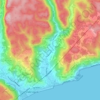
Name: Calvisio topographic map, elevation, terrain.
Location: Calvisio, Finale Ligure, Savona, Liguria, 17024, Italia (44.16564 8.33405 44.20564 8.37405)
Average elevation: 509 ft
Minimum elevation: -3 ft
Maximum elevation: 1,142 ft
Thank you for supporting this site ❤️
Make a donation
Make a donation
Gear up for your next adventure:
As an Amazon Associate, this site earns from qualifying purchases at no extra cost to you.