Geolocate

Mary Ellen topographic map

Click on the map to display elevation.

About this map

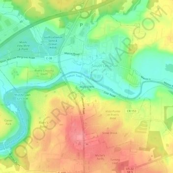
Name: Mary Ellen topographic map, elevation, terrain.

Location: Mary Ellen, South Lebanon, Hamilton Township, Warren County, Ohio, 45065, United States (39.34617 -84.23827 39.38617 -84.19827)

Average elevation: 722 ft

Minimum elevation: 587 ft

Maximum elevation: 873 ft

Warren County trails, hiking, mountain biking, running and outdoor activities

Gear up for your next adventure:

🍳Camping Cook Set - Complete cookware for outdoor meals
🌡️Portable Weather Meter - Track weather conditions on the trail
🦺Reflective Outdoor Gear - Safety gear for low‑light conditions
🧢Sun Protection Hats - Wide-brimmed and UPF-rated hats for high-altitude sun safety
📶Vehicle Signal Boosters - Improve reception in rural areas while driving to trailheads

As an Amazon Associate, this site earns from qualifying purchases at no extra cost to you.