Geolocate

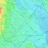
Test Valley topographic map

Click on the map to display elevation.

About this map

Name: Test Valley topographic map, elevation, terrain.

Location: Test Valley, Testwood, New Forest, Hampshire, England, United Kingdom (50.88057 -1.50294 50.95491 -1.39474)

Average elevation: 59 ft

Minimum elevation: -13 ft

Maximum elevation: 272 ft

Other topographic maps

Click on a map to view its topography, its elevation and its terrain.
Totton

United Kingdom > England > Hampshire > New Forest > Testwood

Average elevation: 33 ft

Gear up for your next adventure:

🌡️Handheld Weather Meters - Measure wind, temp, and pressure for safe mountain travel
🧤Tactile Hiking Gloves - Keep hands warm while operating GPS and smartphone screens
🔦Compact Flashlight - Reliable flashlight for emergencies
💧Water Purification System - Clean water on the trail with reliable purifiers
🎒Waterproof Dry Bags - Keep your electronics and maps dry inside your pack

As an Amazon Associate, this site earns from qualifying purchases at no extra cost to you.