Geolocate

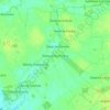
Brok topographic map

Click on the map to display elevation.

About this map

Name: Brok topographic map, elevation, terrain.

Location: Brok, gmina Brok, Ostrów Mazowiecka County, Masovian Voivodeship, Poland (52.67506 21.79236 52.72197 21.96827)

Average elevation: 344 ft

Minimum elevation: 299 ft

Maximum elevation: 420 ft

Other topographic maps

Click on a map to view its topography, its elevation and its terrain.
Gear up for your next adventure:

🗺️Topographic Maps - Detailed topo maps for hiking, exploring and outdoor navigation
🔭Compact Binoculars - HD vision for scouting terrain and identifying distant landmarks
⌚GPS Sports Watch - GPS watch for running, hiking and training
🌧️Backpack Rain Cover - Keep gear dry in wet weather
🖼️Topo Map Wall Art - Decorative topographic prints of famous peaks and regions

As an Amazon Associate, this site earns from qualifying purchases at no extra cost to you.