Geolocate

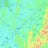
Jinji topographic map

Click on the map to display elevation.

About this map

Name: Jinji topographic map, elevation, terrain.

Location: Jinji, Laibin, Guangxi, China (23.79712 109.50033 23.87712 109.58033)

Average elevation: 259 ft

Minimum elevation: 131 ft

Maximum elevation: 719 ft

Other topographic maps

Click on a map to view its topography, its elevation and its terrain.
Xiangzhou County

China > Guangxi > Laibin

Average elevation: 807 ft

Gear up for your next adventure:

🎒Outdoor Daypacks - Lightweight backpacks designed for carrying maps and essential gear
📡GPS Antenna Upgrade - Enhance GPS reception in remote terrain
🔦LED Headlamp - Bright and durable LED headlamp for night navigation
🔦Compact Flashlight - Reliable flashlight for emergencies
📱Solar Portable Charger - Solar power bank for charging devices off‑grid

As an Amazon Associate, this site earns from qualifying purchases at no extra cost to you.