
Thank you for supporting this site ❤️
Make a donation
Make a donation
Gear up for your next adventure:
As an Amazon Associate, this site earns from qualifying purchases at no extra cost to you.
لیلاس topographic map
Click on the map to display elevation.
Thank you for supporting this site ❤️
Make a donation
Make a donation
Gear up for your next adventure:
As an Amazon Associate, this site earns from qualifying purchases at no extra cost to you.
About this map
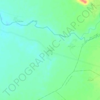
Name: لیلاس topographic map, elevation, terrain.
Location: لیلاس, دهستان سلگی, بخش خزل, شهرستان نهاوند, Iran (34.24877 48.16831 34.28877 48.20831)
Average elevation: 4,905 ft
Minimum elevation: 4,859 ft
Maximum elevation: 5,023 ft
Thank you for supporting this site ❤️
Make a donation
Make a donation
Gear up for your next adventure:
As an Amazon Associate, this site earns from qualifying purchases at no extra cost to you.