

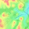
Piedras Rojas topographic map
Click on the map to display elevation.
About this map

Name: Piedras Rojas topographic map, elevation, terrain.
Average elevation: 5,131 ft
Minimum elevation: 4,974 ft
Maximum elevation: 5,469 ft
Other topographic maps
Click on a map to view its topography, its elevation and its terrain.

Ejido Tabalaopa
Mexico > Chihuahua > Municipio de Chihuahua > Chihuahua City
Average elevation: 4,528 ft
Parque El Reliz
Mexico > Chihuahua > Municipio de Chihuahua > Chihuahua City
Average elevation: 4,885 ft