Geolocate

Monticello topographic map

Click on the map to display elevation.

About this map

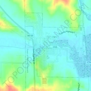
Name: Monticello topographic map, elevation, terrain.

Location: Monticello, Green County, Wisconsin, United States (42.73676 -89.60288 42.75622 -89.57751)

Average elevation: 873 ft

Minimum elevation: 823 ft

Maximum elevation: 1,014 ft

Green County trails, hiking, mountain biking, running and outdoor activities

Other topographic maps

Click on a map to view its topography, its elevation and its terrain.

Juda

United States > Wisconsin > Green County

Average elevation: 902 ft

Attica

United States > Wisconsin > Green County

Average elevation: 876 ft

Dayton

United States > Wisconsin > Green County

Average elevation: 869 ft

Twin Grove

United States > Wisconsin > Green County

Average elevation: 991 ft

Stearns

United States > Wisconsin > Green County

Average elevation: 1,027 ft

Ross Crossing

United States > Wisconsin > Green County

Average elevation: 919 ft

Postville

United States > Wisconsin > Green County

Average elevation: 1,086 ft

Oakley

United States > Wisconsin > Green County

Average elevation: 915 ft

Martintown

United States > Wisconsin > Green County

Average elevation: 827 ft

Brodhead Dam

United States > Wisconsin > Green County

Average elevation: 827 ft

Gear up for your next adventure:

📦Dry Bags Set - Waterproof storage for electronics and clothes
☀️Outdoor Sunscreen - High protection sunscreen for outdoor activities
🔦LED Headlamp - Bright and durable LED headlamp for night navigation
🕶️Glacier Sunglasses - Side shields to protect eyes from high-altitude snow glare
🚑Emergency Bivvies - Heat-reflective sleeping bags for survival situations

As an Amazon Associate, this site earns from qualifying purchases at no extra cost to you.