Geolocate

Isla topographic map

Click on the map to display elevation.

About this map
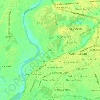
Name: Isla topographic map, elevation, terrain.

Location: Isla, Cabanatuan, Nueva Ecija, Central Luzon, 3100, Philippines (15.47184 120.93680 15.51184 120.97680)

Average elevation: 108 ft

Minimum elevation: 69 ft

Maximum elevation: 128 ft

Other topographic maps

Click on a map to view its topography, its elevation and its terrain.

Gear up for your next adventure:

🪶LED Camping Lantern - Bright lantern for camp lighting
🔭Telescopic Hiking Pole - Adjustable pole for hiking stability
🔋Rechargeable Batteries - Power up your outdoor devices
☀️Outdoor Sunscreen - High protection sunscreen for outdoor activities
📚Navigation Handbooks - Master the art of reading topographic maps and using a compass

As an Amazon Associate, this site earns from qualifying purchases at no extra cost to you.