
Thank you for supporting this site ❤️
Make a donation
Make a donation
Gear up for your next adventure:
As an Amazon Associate, this site earns from qualifying purchases at no extra cost to you.
Camana topographic map
Click on the map to display elevation.
Thank you for supporting this site ❤️
Make a donation
Make a donation
Gear up for your next adventure:
As an Amazon Associate, this site earns from qualifying purchases at no extra cost to you.
About this map
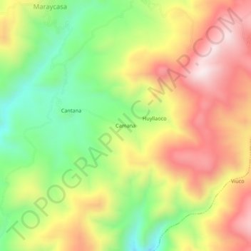
Name: Camana topographic map, elevation, terrain.
Location: Camana, Quicacha, Province of Caravelí, Arequipa, Peru (-15.49378 -73.67080 -15.45378 -73.63080)
Average elevation: 11,280 ft
Minimum elevation: 10,289 ft
Maximum elevation: 12,300 ft
Thank you for supporting this site ❤️
Make a donation
Make a donation
Gear up for your next adventure:
As an Amazon Associate, this site earns from qualifying purchases at no extra cost to you.