Geolocate

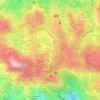
Hilltop Kayang topographic map

Click on the map to display elevation.

About this map

Name: Hilltop Kayang topographic map, elevation, terrain.

Location: Hilltop Kayang, District 18, Baguio, Cordillera Administrative Region, 2600, Philippines (16.41442 120.59333 16.41588 120.59577)

Average elevation: 4,741 ft

Minimum elevation: 4,472 ft

Maximum elevation: 5,085 ft

Other topographic maps

Click on a map to view its topography, its elevation and its terrain.
SLU-SVP Housing Village

Philippines > Baguio

Average elevation: 4,521 ft

Burnham Park

Philippines > Baguio > Harrison-Claudio-Carantes

Average elevation: 4,741 ft

Panagbenga Park

Philippines > Baguio > South Drive

Average elevation: 4,731 ft

Happy Homes

Philippines > Baguio

Average elevation: 4,741 ft

Kagitingan

Philippines > Baguio

Average elevation: 4,783 ft

Poblacion

Philippines > Baguio

Average elevation: 4,239 ft

DPS Compound

Philippines > Baguio > DPS Compound

Average elevation: 4,682 ft

Ambiong

Philippines > Baguio > Ambiong

Average elevation: 4,862 ft

Harrison-Claudio-Carantes

Philippines > Baguio

Average elevation: 4,744 ft

South Drive

Philippines > Baguio

Average elevation: 4,682 ft

Gear up for your next adventure:

🥩Freeze-Dried Meals - Nutritious and lightweight food for remote expeditions
🎒Gear Packing Cubes - Organize your backpack efficiently
🚁Photography Drones - Capture stunning aerial views of landforms and topography
🥘Titanium Cookware - Durable, featherlight pots and pans for backpacking
🧤Tactile Hiking Gloves - Keep hands warm while operating GPS and smartphone screens

As an Amazon Associate, this site earns from qualifying purchases at no extra cost to you.