Geolocate

Akhnoor topographic map

Click on the map to display elevation.

About this map

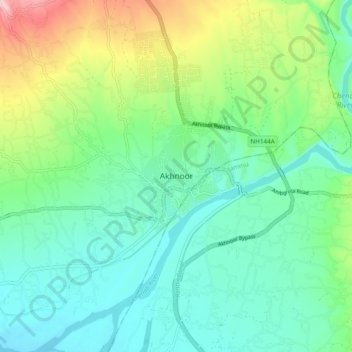
Name: Akhnoor topographic map, elevation, terrain.

Location: Akhnoor, Jammu, Jammu and Kashmir, 181200, India (32.86195 74.69474 32.94195 74.77474)

Average elevation: 1,171 ft

Minimum elevation: 965 ft

Maximum elevation: 1,713 ft

Gear up for your next adventure:

🪶Camp Gear Gift Set - Perfect gift bundle for outdoor fans
🧤Hiking Gloves - Protective gloves for rugged trails
🛰️Satellite Messengers - Emergency SOS and two-way messaging for off-grid adventures
🧢Sun Protection Hats - Wide-brimmed and UPF-rated hats for high-altitude sun safety
🦶Hiking Gaiters - Keep debris and water out of your boots

As an Amazon Associate, this site earns from qualifying purchases at no extra cost to you.