Geolocate

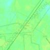
Tall PInes topographic map

Click on the map to display elevation.

About this map

Name: Tall PInes topographic map, elevation, terrain.

Location: Tall PInes, Berkeley County, South Carolina, 29456, United States (32.99017 -80.12537 33.03017 -80.08537)

Average elevation: 43 ft

Minimum elevation: 7 ft

Maximum elevation: 75 ft

Other topographic maps

Click on a map to view its topography, its elevation and its terrain.
Hanahan

United States > South Carolina > Berkeley County

Average elevation: 23 ft

Bonneau

United States > South Carolina > Berkeley County

Average elevation: 59 ft

Ladson

United States > South Carolina > Berkeley County

Average elevation: 46 ft

Hanahan

United States > South Carolina > Berkeley County

Average elevation: 20 ft

Hanahan

United States > South Carolina > Berkeley County

Average elevation: 23 ft

Ladson

United States > South Carolina > Berkeley County

Average elevation: 46 ft

Bonneau

United States > South Carolina > Berkeley County

Average elevation: 59 ft

Gear up for your next adventure:

📚Navigation Handbooks - Master the art of reading topographic maps and using a compass
🥇GPS Hiking Watch - Multi‑sport GPS watch with navigation and trail tracking
🎒Trekking Poles - Sturdy poles for balance and stability on rough terrain
🧤Hiking Gloves - Protective gloves for rugged trails
🏫Relief Map Kits - Hands-on tools for teaching landforms and elevation

As an Amazon Associate, this site earns from qualifying purchases at no extra cost to you.