Geolocate

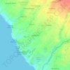
Kaba-kaba topographic map

Click on the map to display elevation.

About this map

Name: Kaba-kaba topographic map, elevation, terrain.

Location: Kaba-kaba, Kediri, Tabanan, Bali, 82121, Indonesia (-8.60939 115.12464 -8.58095 115.15122)

Average elevation: 226 ft

Minimum elevation: 98 ft

Maximum elevation: 335 ft

Other topographic maps

Click on a map to view its topography, its elevation and its terrain.
Batugaing

Indonesia > Bali > Kediri > Beraban

Average elevation: 75 ft

Gear up for your next adventure:

🏕️Tent Footprint - Protect your tent base from wear
🪶Camping Sleeping Pad - Comfortable sleeping pad for backpacking
❄️Traction Cleats - Prevent slips on icy trails during winter hikes
🪶Camp Gear Gift Set - Perfect gift bundle for outdoor fans
🌡️Portable Weather Meter - Track weather conditions on the trail

As an Amazon Associate, this site earns from qualifying purchases at no extra cost to you.