Geolocate

Robins topographic map

Click on the map to display elevation.

About this map
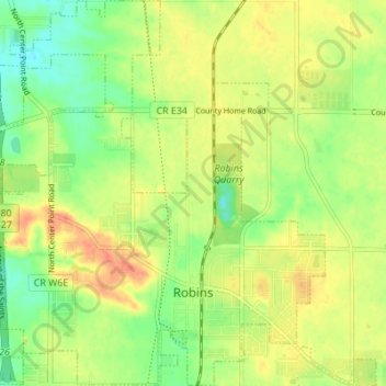
Name: Robins topographic map, elevation, terrain.

Location: Robins, Linn County, Iowa, 52328, United States (42.05869 -91.70208 42.10953 -91.64337)

Average elevation: 860 ft

Minimum elevation: 784 ft

Maximum elevation: 935 ft

Linn County trails, hiking, mountain biking, running and outdoor activities

Other topographic maps

Click on a map to view its topography, its elevation and its terrain.

New Buffalo

United States > Iowa > Linn County > Cedar Rapids

Average elevation: 830 ft

Viola

United States > Iowa > Linn County

Average elevation: 919 ft

Lindale Manor

United States > Iowa > Linn County > Marion

Average elevation: 827 ft

Covington

United States > Iowa > Linn County

Average elevation: 784 ft

Paris

United States > Iowa > Linn County

Average elevation: 883 ft

Gear up for your next adventure:

📷Action Camera - Capture your outdoor adventures in HD
🗻Climbing Gear Basics - Essential gear for beginner climbers
🎒Waterproof Dry Bags - Keep your electronics and maps dry inside your pack
🥇GPS Hiking Watch - Multi‑sport GPS watch with navigation and trail tracking
📖Nature Tracking Books - Learn to track wildlife and terrain

As an Amazon Associate, this site earns from qualifying purchases at no extra cost to you.