
Thank you for supporting this site ❤️
Make a donation
Make a donation
Gear up for your next adventure:
As an Amazon Associate, this site earns from qualifying purchases at no extra cost to you.
Beffeux topographic map
Click on the map to display elevation.
Thank you for supporting this site ❤️
Make a donation
Make a donation
Gear up for your next adventure:
As an Amazon Associate, this site earns from qualifying purchases at no extra cost to you.
About this map
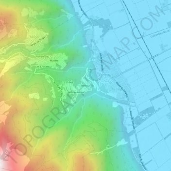
Name: Beffeux topographic map, elevation, terrain.
Location: Beffeux, Torgon, Vionnaz, Monthey, Valais, 1899, Suisse (46.28858 6.87360 46.32858 6.91360)
Average elevation: 2,444 ft
Minimum elevation: 1,230 ft
Maximum elevation: 6,201 ft
Thank you for supporting this site ❤️
Make a donation
Make a donation
Gear up for your next adventure:
As an Amazon Associate, this site earns from qualifying purchases at no extra cost to you.