Geolocate

Seborga topographic map

Click on the map to display elevation.

About this map

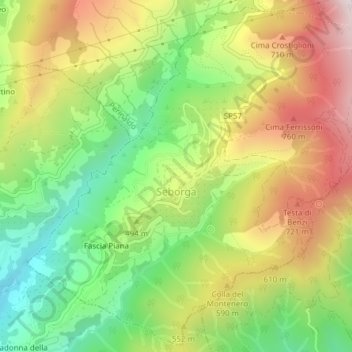
Name: Seborga topographic map, elevation, terrain.

Location: Seborga, Imperia, Liguria, Italy (43.81441 7.67826 43.84083 7.71645)

Average elevation: 1,558 ft

Minimum elevation: 427 ft

Maximum elevation: 2,907 ft

Gear up for your next adventure:

🔌USB Car Charger - Car charger for on‑the‑go power needs
🗺️Topographic Maps - Detailed topo maps for hiking, exploring and outdoor navigation
🪶Camp Gear Gift Set - Perfect gift bundle for outdoor fans
🧢Sun Protection Hats - Wide-brimmed and UPF-rated hats for high-altitude sun safety
👟Trail Running Shoes - Lightweight shoes for trail runners

As an Amazon Associate, this site earns from qualifying purchases at no extra cost to you.