
Thank you for supporting this site ❤️
Make a donation
Make a donation
Gear up for your next adventure:
As an Amazon Associate, this site earns from qualifying purchases at no extra cost to you.
Miriam topographic map
Click on the map to display elevation.
Thank you for supporting this site ❤️
Make a donation
Make a donation
Gear up for your next adventure:
As an Amazon Associate, this site earns from qualifying purchases at no extra cost to you.
About this map
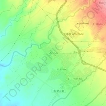
Name: Miriam topographic map, elevation, terrain.
Location: Miriam, Santa Lucía Cotzumalguapa, Escuintla, Guatemala (14.28866 -91.07768 14.32866 -91.03768)
Average elevation: 833 ft
Minimum elevation: 659 ft
Maximum elevation: 1,083 ft
Thank you for supporting this site ❤️
Make a donation
Make a donation
Gear up for your next adventure:
As an Amazon Associate, this site earns from qualifying purchases at no extra cost to you.