
Thank you for supporting this site ❤️
Make a donation
Make a donation
Gear up for your next adventure:
As an Amazon Associate, this site earns from qualifying purchases at no extra cost to you.
Rommerz topographic map
Click on the map to display elevation.
Thank you for supporting this site ❤️
Make a donation
Make a donation
Gear up for your next adventure:
As an Amazon Associate, this site earns from qualifying purchases at no extra cost to you.
About this map
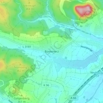
Name: Rommerz topographic map, elevation, terrain.
Location: Rommerz, Neuhof, Landkreis Fulda, Hessen, 36119, Deutschland (50.43105 9.55867 50.47105 9.59867)
Average elevation: 1,047 ft
Minimum elevation: 889 ft
Maximum elevation: 1,640 ft
Thank you for supporting this site ❤️
Make a donation
Make a donation
Gear up for your next adventure:
As an Amazon Associate, this site earns from qualifying purchases at no extra cost to you.