Geolocate

Checkerberry Village topographic map

Click on the map to display elevation.

About this map

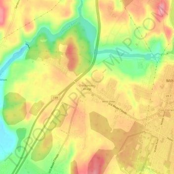
Name: Checkerberry Village topographic map, elevation, terrain.

Location: Checkerberry Village, Milton, Chittenden County, Vermont, 05468, United States (44.60889 -73.16343 44.64889 -73.12343)

Average elevation: 292 ft

Minimum elevation: 85 ft

Maximum elevation: 449 ft

Chittenden County trails, hiking, mountain biking, running and outdoor activities

Other topographic maps

Click on a map to view its topography, its elevation and its terrain.

Gear up for your next adventure:

🛶Inflatable Kayak - Portable kayak for rivers, lakes, and expeditions
🧼Biodegradable Camping Soap - Eco‑friendly soap for outdoor hygiene
🧥Waterproof Jacket for Hiking - Breathable and rugged rain jacket for outdoor excursions
🌡️Portable Weather Meter - Track weather conditions on the trail
🪶LED Camping Lantern - Bright lantern for camp lighting

As an Amazon Associate, this site earns from qualifying purchases at no extra cost to you.