
Thank you for supporting this site ❤️
Make a donation
Make a donation
Gear up for your next adventure:
As an Amazon Associate, this site earns from qualifying purchases at no extra cost to you.
Ilaló topographic map
Click on the map to display elevation.
Thank you for supporting this site ❤️
Make a donation
Make a donation
Gear up for your next adventure:
As an Amazon Associate, this site earns from qualifying purchases at no extra cost to you.
About this map
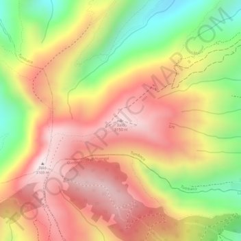
Name: Ilaló topographic map, elevation, terrain.
Location: Ilaló, Tumbaco, Quito Canton, Pichincha, 170184, Ecuador (-0.25805 -78.41067 -0.25795 -78.41057)
Average elevation: 9,629 ft
Minimum elevation: 8,474 ft
Maximum elevation: 10,446 ft
Thank you for supporting this site ❤️
Make a donation
Make a donation
Gear up for your next adventure:
As an Amazon Associate, this site earns from qualifying purchases at no extra cost to you.