
Make a donation
Gear up for your next adventure:
As an Amazon Associate, this site earns from qualifying purchases at no extra cost to you.
South Whitley topographic map
Click on the map to display elevation.
Make a donation
Gear up for your next adventure:
As an Amazon Associate, this site earns from qualifying purchases at no extra cost to you.
About this map
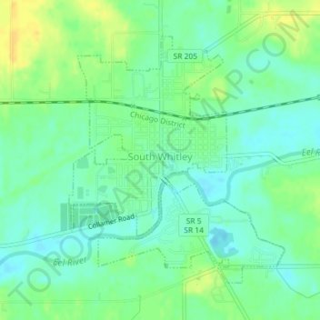
Name: South Whitley topographic map, elevation, terrain.
Location: South Whitley, Whitley County, Indiana, United States (41.07404 -85.63826 41.09491 -85.61413)
Average elevation: 814 ft
Minimum elevation: 781 ft
Maximum elevation: 860 ft
Whitley County trails, hiking, mountain biking, running and outdoor activities
Make a donation
Gear up for your next adventure:
As an Amazon Associate, this site earns from qualifying purchases at no extra cost to you.
Other topographic maps
Click on a map to view its topography, its elevation and its terrain.
Columbia City
United States > Indiana > Whitley County > Columbia City > Columbia City
Average elevation: 853 ft