
Thank you for supporting this site ❤️
Make a donation
Make a donation
Gear up for your next adventure:
As an Amazon Associate, this site earns from qualifying purchases at no extra cost to you.
Balboutet topographic map
Click on the map to display elevation.
Thank you for supporting this site ❤️
Make a donation
Make a donation
Gear up for your next adventure:
As an Amazon Associate, this site earns from qualifying purchases at no extra cost to you.
About this map
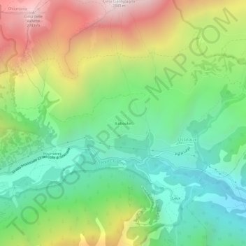
Name: Balboutet topographic map, elevation, terrain.
Location: Balboutet, Usseaux, Turin, Piémont, Italie (45.03159 6.99394 45.07159 7.03394)
Average elevation: 5,863 ft
Minimum elevation: 3,806 ft
Maximum elevation: 9,281 ft
Thank you for supporting this site ❤️
Make a donation
Make a donation
Gear up for your next adventure:
As an Amazon Associate, this site earns from qualifying purchases at no extra cost to you.