Geolocate

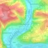
Neubrunn topographic map

Click on the map to display elevation.

About this map

Name: Neubrunn topographic map, elevation, terrain.

Location: Neubrunn, Landkreis Würzburg, Bavaria, 97277, Germany (49.68710 9.62550 49.75411 9.71625)

Average elevation: 1,004 ft

Minimum elevation: 541 ft

Maximum elevation: 1,266 ft

Other topographic maps

Click on a map to view its topography, its elevation and its terrain.
Dipbach

Germany > Bavaria > Landkreis Würzburg

Average elevation: 925 ft

Obereisenheim

Germany > Bavaria > Landkreis Würzburg

Average elevation: 804 ft

Gear up for your next adventure:

🧭Orienteering Set - Complete compass and map reading kit
🗺️Topographic Maps - Detailed topo maps for hiking, exploring and outdoor navigation
🔥Fast-Boil Camping Stoves - Efficient cooking systems for quick trail meals
🌐World Map Poster - Decorative world maps with topographic info
🔭Telescopic Hiking Pole - Adjustable pole for hiking stability

As an Amazon Associate, this site earns from qualifying purchases at no extra cost to you.