Geolocate

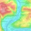
Neubrunn topographic map

Click on the map to display elevation.

About this map

Name: Neubrunn topographic map, elevation, terrain.

Location: Neubrunn, Landkreis Würzburg, Bavaria, 97277, Germany (49.68710 9.62550 49.75411 9.71625)

Average elevation: 1,004 ft

Minimum elevation: 541 ft

Maximum elevation: 1,266 ft

Other topographic maps

Click on a map to view its topography, its elevation and its terrain.
Dipbach

Germany > Bavaria > Landkreis Würzburg

Average elevation: 925 ft

Obereisenheim

Germany > Bavaria > Landkreis Würzburg

Average elevation: 804 ft

Gear up for your next adventure:

🔌USB Car Charger - Car charger for on‑the‑go power needs
🛠️Outdoor Gear Repair Kit - Essential tools to fix gear on the trail
⌚GPS Sports Watch - GPS watch for running, hiking and training
🦟Ultrasonic Repellers - Create a bug-free zone at your camp or rest stop
📷Action Cameras - Rugged cameras to document your journeys across rugged terrain

As an Amazon Associate, this site earns from qualifying purchases at no extra cost to you.