Geolocate

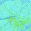
The Hague topographic map

Click on the map to display elevation.

About this map
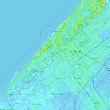
Name: The Hague topographic map, elevation, terrain.

Location: The Hague, South Holland, Netherlands (52.01485 4.18500 52.13504 4.42249)

Average elevation: 7 ft

Minimum elevation: -26 ft

Maximum elevation: 92 ft

Other topographic maps

Click on a map to view its topography, its elevation and its terrain.

Tweede Tol

Netherlands > South Holland > Dordrecht

Average elevation: 0 ft

Gooland

Netherlands > South Holland > Nootdorp

Average elevation: -7 ft

Langeraar

Netherlands > South Holland

Average elevation: -10 ft

Waalhaven

Netherlands > South Holland > Rotterdam

Average elevation: 10 ft

Meijendel

Netherlands > South Holland > Wassenaar

Average elevation: 20 ft

Meije

Netherlands > South Holland > Nieuwkoop

Average elevation: -7 ft

Ankerpark

Netherlands > South Holland > Leiden

Average elevation: 10 ft

Botlek

Netherlands > South Holland

Average elevation: 10 ft

Weerestein

Netherlands > South Holland > Hillegom

Average elevation: 0 ft

Weerestein

Netherlands > South Holland > Hillegom

Average elevation: 0 ft

Coepelduynen

Netherlands > South Holland > Katwijk

Average elevation: 13 ft

Middelsluis

Netherlands > South Holland > Numansdorp

Average elevation: 0 ft

Broekhuizen

Netherlands > South Holland > Gouda

Average elevation: -3 ft

Het Park

Netherlands > South Holland > Rotterdam

Average elevation: 13 ft

Gear up for your next adventure:

⛺Backpacking Tent - Lightweight and durable tent for multi‑day hikes
⌚GPS Sports Watch - GPS watch for running, hiking and training
🧣Merino Neck Gaiters - Multi-functional headwear for wind and sun protection
🧤Hiking Gloves - Protective gloves for rugged trails
🥇GPS Hiking Watch - Multi‑sport GPS watch with navigation and trail tracking

As an Amazon Associate, this site earns from qualifying purchases at no extra cost to you.