Geolocate

Rotterdam topographic maps

Click on a map to view its topography, its elevation and its terrain.

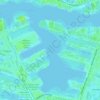
Waalhaven

Netherlands > South Holland > Rotterdam

Average elevation: 10 ft

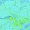
Het Park

Netherlands > South Holland > Rotterdam

Average elevation: 13 ft

Gear up for your next adventure:

🧯Portable Fire Pit - Compact fire pit for camping spots
🗺️NatGeo Topo Maps - High-quality waterproof printed topographic maps of US Parks
☕Camping Coffee Makers - Enjoy premium coffee at the summit or campsite
📱Solar Portable Charger - Solar power bank for charging devices off‑grid
🛠️Backpacking Tool Kit - Essential toolkit for outdoor repairs

As an Amazon Associate, this site earns from qualifying purchases at no extra cost to you.