Geolocate

Mariners Point topographic map

Click on the map to display elevation.

About this map

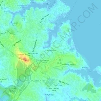
Name: Mariners Point topographic map, elevation, terrain.

Location: Mariners Point, Annapolis, Anne Arundel County, Maryland, 21403, United States (38.93511 -76.50385 38.97511 -76.46385)

Average elevation: 23 ft

Minimum elevation: -13 ft

Maximum elevation: 112 ft

Other topographic maps

Click on a map to view its topography, its elevation and its terrain.

Gear up for your next adventure:

🧯Emergency Survival Kit - All‑in‑one survival essentials for the backcountry
🌐World Map Poster - Decorative world maps with topographic info
👖Convertible Hiking Pants - Versatile zip-off pants for changing altitudes and temperatures
🪄Magnetic Compass - Accurate compass for navigation
🧤Hiking Gloves - Protective gloves for rugged trails

As an Amazon Associate, this site earns from qualifying purchases at no extra cost to you.