
Thank you for supporting this site ❤️
Make a donation
Make a donation
Gear up for your next adventure:
As an Amazon Associate, this site earns from qualifying purchases at no extra cost to you.
Siguis topographic map
Click on the map to display elevation.
Thank you for supporting this site ❤️
Make a donation
Make a donation
Gear up for your next adventure:
As an Amazon Associate, this site earns from qualifying purchases at no extra cost to you.
About this map
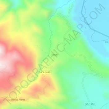
Name: Siguis topographic map, elevation, terrain.
Location: Siguis, Cachachi, Cajabamba, Cajamarca, Perú (-7.58545 -78.19720 -7.54545 -78.15720)
Average elevation: 7,572 ft
Minimum elevation: 6,722 ft
Maximum elevation: 9,006 ft
Thank you for supporting this site ❤️
Make a donation
Make a donation
Gear up for your next adventure:
As an Amazon Associate, this site earns from qualifying purchases at no extra cost to you.