Geolocate

Kiedrich topographic map

Click on the map to display elevation.

About this map

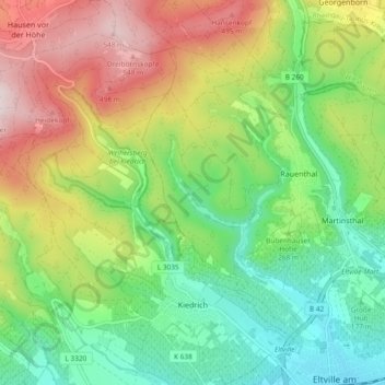
Name: Kiedrich topographic map, elevation, terrain.

Location: Kiedrich, Rheingau-Taunus-Kreis, Hesse, 65399, Germany (50.02765 8.04415 50.08765 8.10913)

Average elevation: 925 ft

Minimum elevation: 305 ft

Maximum elevation: 1,893 ft

Gear up for your next adventure:

🔭Telescopic Hiking Pole - Adjustable pole for hiking stability
📦Gear Storage Bags - Organize and protect outdoor equipment
💧Water Filtration Bottles - Safely drink from streams and lakes while exploring
🥾Hiking Shoes - Durable and comfortable shoes for trail hiking
🧭Outdoor Navigation Book - Learn advanced navigation skills

As an Amazon Associate, this site earns from qualifying purchases at no extra cost to you.