
Thank you for supporting this site ❤️
Make a donation
Make a donation
Gear up for your next adventure:
As an Amazon Associate, this site earns from qualifying purchases at no extra cost to you.
Bakkal topographic map
Click on the map to display elevation.
Thank you for supporting this site ❤️
Make a donation
Make a donation
Gear up for your next adventure:
As an Amazon Associate, this site earns from qualifying purchases at no extra cost to you.
About this map
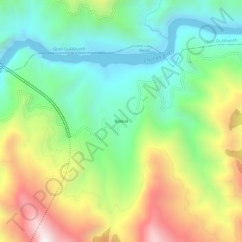
Name: Bakkal topographic map, elevation, terrain.
Location: Bakkal, Reasi, Reasi District, Jammu and Kashmir, India (33.12174 74.88642 33.16174 74.92642)
Average elevation: 3,025 ft
Minimum elevation: 1,617 ft
Maximum elevation: 5,417 ft
Thank you for supporting this site ❤️
Make a donation
Make a donation
Gear up for your next adventure:
As an Amazon Associate, this site earns from qualifying purchases at no extra cost to you.