
Thank you for supporting this site ❤️
Make a donation
Make a donation
Gear up for your next adventure:
As an Amazon Associate, this site earns from qualifying purchases at no extra cost to you.
Tonk topographic map
Click on the map to display elevation.
Thank you for supporting this site ❤️
Make a donation
Make a donation
Gear up for your next adventure:
As an Amazon Associate, this site earns from qualifying purchases at no extra cost to you.
About this map
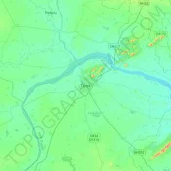
Name: Tonk topographic map, elevation, terrain.
Location: Tonk, Tonk Tehsil, Tonk District, Rajasthan, 304001, India (26.00124 75.62581 26.32124 75.94581)
Average elevation: 925 ft
Minimum elevation: 820 ft
Maximum elevation: 1,490 ft
Thank you for supporting this site ❤️
Make a donation
Make a donation
Gear up for your next adventure:
As an Amazon Associate, this site earns from qualifying purchases at no extra cost to you.