Geolocate

Ciwidey topographic map

Click on the map to display elevation.

About this map

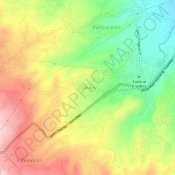
Name: Ciwidey topographic map, elevation, terrain.

Location: Ciwidey, Kabupaten Bandung, Java, 40972, Indonesia (-7.14272 107.42417 -7.06272 107.50417)

Average elevation: 3,953 ft

Minimum elevation: 2,917 ft

Maximum elevation: 5,535 ft

Other topographic maps

Click on a map to view its topography, its elevation and its terrain.

Soreang

Indonesia > Kabupaten Bandung

Average elevation: 2,444 ft

Gear up for your next adventure:

🛌Ultralight Sleeping Bags - Compact down bags for cold nights in the wilderness
🛠️Outdoor Gear Repair Kit - Essential tools to fix gear on the trail
🪑Ultralight Camp Chairs - Portable seating for resting after a long day of mapping
🪶Trail Camera - Capture wildlife on your hikes
🧭Orienteering Set - Complete compass and map reading kit

As an Amazon Associate, this site earns from qualifying purchases at no extra cost to you.