Geolocate

Libarna topographic map

Click on the map to display elevation.

About this map

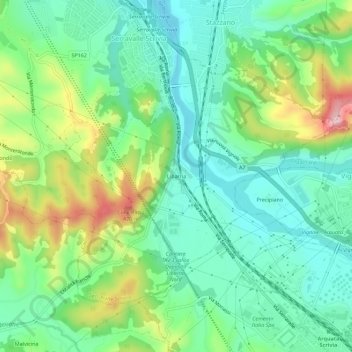
Name: Libarna topographic map, elevation, terrain.

Location: Libarna, Serravalle Scrivia, Alessandria, Piedmont, 15069, Italy (44.68990 8.84072 44.72990 8.88072)

Average elevation: 879 ft

Minimum elevation: 617 ft

Maximum elevation: 1,457 ft

Gear up for your next adventure:

🕶️GPS Smartphone Mount - Secure mount for phone navigation
🧥Waterproof Jacket for Hiking - Breathable and rugged rain jacket for outdoor excursions
🔭Compact Binoculars - HD vision for scouting terrain and identifying distant landmarks
🪶Thermal Camp Blanket - Extra warmth for cold nights
🛠️Backpacking Tool Kit - Essential toolkit for outdoor repairs

As an Amazon Associate, this site earns from qualifying purchases at no extra cost to you.