Geolocate

Bamberg topographic map

Click on the map to display elevation.

About this map

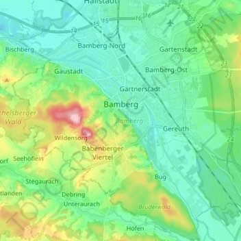
Name: Bamberg topographic map, elevation, terrain.

Location: Bamberg, Bavaria, Germany (49.84265 10.82650 49.92863 10.96070)

Average elevation: 876 ft

Minimum elevation: 738 ft

Maximum elevation: 1,266 ft

Other topographic maps

Click on a map to view its topography, its elevation and its terrain.

Armöd

Germany > Bavaria > Landkreis Dingolfing-Landau > Englmannsberg

Average elevation: 1,407 ft

Gear up for your next adventure:

GPS Sports Watch - GPS watch for running, hiking and training
🔪Outdoor Multitools - Essential survival tools for gear repair and field use
🪑Portable Camp Table - Compact table for campsite meals
🧯Portable Fire Pit - Compact fire pit for camping spots
🗺️NatGeo Topo Maps - High-quality waterproof printed topographic maps of US Parks

As an Amazon Associate, this site earns from qualifying purchases at no extra cost to you.