Geolocate

Dhandal topographic map

Click on the map to display elevation.

About this map

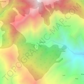
Name: Dhandal topographic map, elevation, terrain.

Location: Dhandal, Gurmul, Doda, Jammu and Kashmir, 182145, India (33.17726 75.39749 33.21726 75.43749)

Average elevation: 7,808 ft

Minimum elevation: 4,980 ft

Maximum elevation: 10,725 ft

Gear up for your next adventure:

📦Gear Storage Bags - Organize and protect outdoor equipment
🧺Microfiber Travel Towels - Compact and fast-drying towels for trail use
🪶LED Camping Lantern - Bright lantern for camp lighting
🎒Outdoor Daypacks - Lightweight backpacks designed for carrying maps and essential gear
🔭Stargazing Telescopes - Perfect for camping in low-light pollution areas shown on maps

As an Amazon Associate, this site earns from qualifying purchases at no extra cost to you.