Geolocate

Wolfsburg topographic map

Click on the map to display elevation.

About this map

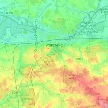
Name: Wolfsburg topographic map, elevation, terrain.

Location: Wolfsburg, Lower Saxony, Germany (52.31593 10.64711 52.49509 10.90684)

Average elevation: 276 ft

Minimum elevation: 154 ft

Maximum elevation: 528 ft

Gear up for your next adventure:

🛡️Insect Repellent - Protection against bugs during outdoor activities
😴Insulated Sleeping Pads - Compact and warm pads for high-elevation camping
🎁Geography Themed Gifts - Unique gift ideas for map lovers and geography enthusiasts
👟Men's Trail Runners - Lightweight footwear for fast-paced exploration and light hiking
📚USA Hiking Guide Books - Top trail guides and map books

As an Amazon Associate, this site earns from qualifying purchases at no extra cost to you.