
Thank you for supporting this site ❤️
Make a donation
Make a donation
Gear up for your next adventure:
As an Amazon Associate, this site earns from qualifying purchases at no extra cost to you.
Holzkirchen topographic map
Click on the map to display elevation.
Thank you for supporting this site ❤️
Make a donation
Make a donation
Gear up for your next adventure:
As an Amazon Associate, this site earns from qualifying purchases at no extra cost to you.
About this map
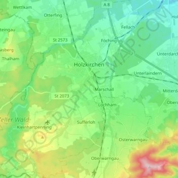
Name: Holzkirchen topographic map, elevation, terrain.
Location: Holzkirchen, Landkreis Miesbach, Bavaria, 83607, Germany (47.82148 11.60818 47.91806 11.74461)
Average elevation: 2,303 ft
Minimum elevation: 2,047 ft
Maximum elevation: 2,956 ft
Thank you for supporting this site ❤️
Make a donation
Make a donation
Gear up for your next adventure:
As an Amazon Associate, this site earns from qualifying purchases at no extra cost to you.