
Thank you for supporting this site ❤️
Make a donation
Make a donation
Gear up for your next adventure:
As an Amazon Associate, this site earns from qualifying purchases at no extra cost to you.
Jhimar topographic map
Click on the map to display elevation.
Thank you for supporting this site ❤️
Make a donation
Make a donation
Gear up for your next adventure:
As an Amazon Associate, this site earns from qualifying purchases at no extra cost to you.
About this map
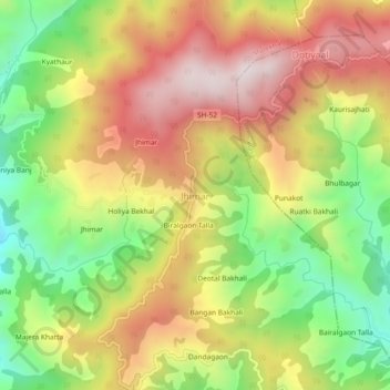
Name: Jhimar topographic map, elevation, terrain.
Location: Jhimar, Molekhal, Almora, Uttarakhand, India (29.72613 79.13525 29.76613 79.17525)
Average elevation: 5,456 ft
Minimum elevation: 4,173 ft
Maximum elevation: 6,719 ft
Thank you for supporting this site ❤️
Make a donation
Make a donation
Gear up for your next adventure:
As an Amazon Associate, this site earns from qualifying purchases at no extra cost to you.