
Thank you for supporting this site ❤️
Make a donation
Make a donation
Gear up for your next adventure:
As an Amazon Associate, this site earns from qualifying purchases at no extra cost to you.
Gbadolite topographic map
Click on the map to display elevation.
Thank you for supporting this site ❤️
Make a donation
Make a donation
Gear up for your next adventure:
As an Amazon Associate, this site earns from qualifying purchases at no extra cost to you.
About this map
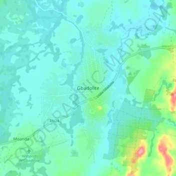
Name: Gbadolite topographic map, elevation, terrain.
Location: Gbadolite, Nord-Ubangi, Democratic Republic of the Congo (4.24124 20.95991 4.32124 21.03991)
Average elevation: 1,335 ft
Minimum elevation: 1,270 ft
Maximum elevation: 1,647 ft
Thank you for supporting this site ❤️
Make a donation
Make a donation
Gear up for your next adventure:
As an Amazon Associate, this site earns from qualifying purchases at no extra cost to you.